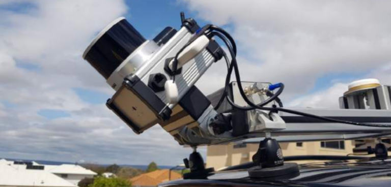
Australian geospatial innovation company, Klau Geomatics, has brought in a solution from navigation technology company Oxford Technical Solutions (OxTS) to help it boresight and georeference lidar data with NovAtel navigation data.
The initial focus of Klau Geomatics’ scheme was to produce an accurate aerial lidar system, with the company then realising it could use the knowledge gained during the project to
simultaneously develop a vehicle-mounted, mobile lidar scanning product.
The team at the geospatial technology firm, which shares a mix of hardware and software expertise, has experience with NovAtel products, which led to two challenges: the calibration of coordinate frames of the navigation device and lidar sensor and the geofencing of lidar data to create a pointcloud.
Failure to align the coordinate frames of the navigation and lidar devices accurately could lead to the pointcloud blurring and ‘double-vision’.
Klau Geomatics was previously using a NovAtel GNSS/INS device and a lidar sensor and needed to stick with its NovAtel-supplied device based on the teams’ experience with the hardware.
What’s more, there were additional difficulties with developing a complex in-house solution based on the team’s size.
Klau Geomatics realised it needed the support of a company with expertise in georeferencing and calibrating high-precision INS and lidar sensors, and so sought out OxTS.
OxTS supplied its georeferencing software tool to combine INS navigation data with raw lidar data, which it claims can be used alongside any INS and many lidar sensors to create a georeferenced pointcloud.
It likewise provided Klau Geomatics with its boresight calibration tool, which comes as an optional extra within OxTS’ georeferencer. The tool allows users of OxTS georeferencer to calibrate the coordinate frames of lidar and INS devices.
As a result of this calibration, the risk of blurring and ‘double-vision’ from pointclouds is eliminated as the tool surveys two retroreflective ‘targets’. The software then uses the data to align the coordinate frames of the devices precisely.
Once the project was underway, OxTS worked with Klau Geomatics to support both
NovAtel INS data and its various supported lidar scanners.
Before receiving the test version of OxTS Georeferencer, Klau Geomatics built a payload that included multiple scanning devices. Once they received the licence, testing began.
“Klau Geomatics has built its success on NovAtel to date,” said Rob Klau, director of Klau Geomatics.
“We will continue with this philosophy in collaboration with OxTS who has helped us overcome some of our most difficult sensor calibration challenges.”
The accuracy of the boresight calibration tool within OxTS georeferencer helped Klau Geomatics realise that the lidar sensor it was using for data collection was ‘noisy’ and not well suited to the high-accuracy geospatial work its customers would be using the systems for.
By engaging with OxTS, Klau Geomatics claims it was able to speed up the development phase of its project and ensure the rapid rollout of other product components.
Oxford Technical Solutions (Stand r104) will be exhibiting at Robotics and Automation 2023, which will be co-located with IntraLogisteX 2023. To attend to visit for free, or to find out more, visit www.roboticsandautomation.co.uk or www.intralogistex.co.uk.


