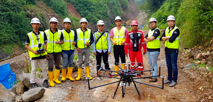
Terra Drone, an industrial drone solutions company, has announced the completion of over 1,000 lidar survey projects throughout 2020.
The company conducted topographic surveys using unmanned aerial vehicles (UAVs), lidar and photogrammetry across the world last year, as it expanded its drone survey capability globally.
According to the UAV firm, the use of drone lidar surveys in the UK, Europe, Middle East and Africa increased efficiency and generated accurate 3D modelling.
What’s more, the UAVs enabled teams to survey areas featuring challenging terrain that, according to Terra Drone, would have been “very difficult and time consuming” using conventional methods.

In Japan, Terra Drone completed UAV lidar surveys of more than 700 projects in one year for baseline surveys.
The topography of most of the areas surveyed are covered by vegetation and very hilly, which lends itself to demand for a digital terrain model (DTM) for construction design, said Terra Drone.
The situation in Indonesia and Malaysia are similar and drone lidar survey has been beneficial for conducting baseline surveys for designing infrastructures, disaster management and mining explorations.
Toru Tokushige, CEO of Terra Drone, said: “We conduct surveys and inspections worldwide especially having a strong presence in Asia and Europe.
“In the future, we see a large potential in the Middle East and African markets to implement technology and experiences of drone lidar survey due to its rising demand for constructing new facilities and infrastructures.
“There are many benefits that drones can provide for large area surveys in general to increase its productivity and the quality of the outputs.”


