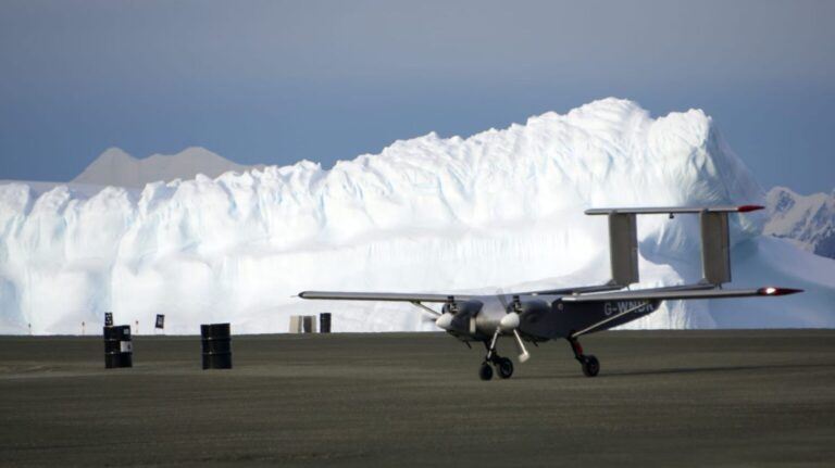
A drone has been deployed in Antarctica by British researchers to monitor the impacts of climate change on the continent.
The autonomous robotic aircraft will be used to map areas that researchers have been unable to reach previously, and has been tested for Antarctic conditions in the extreme weather of Snowdonia in North Wales.
Stage one of the deployment will see the drone survey the mountains beneath an ice sheet, with this data offering a picture of the timescale for the ice to melt and cause a global rise in sea level.
Scientists hope that a better understanding of the continent’s topography will lead to more accurate predictions in this area.
UK firm Windracers supported the building of the drone, which is reportedly equipped for easy repairs and can handle below-freezing temperatures and sudden storms.
What’s more, the device can carry 100kg of cargo for a distance of up to 1,000km.
The drone’s back is fitted with radar and cameras; in the first experiment, the onboard radar will fire radio waves at Fuchs Piedmont.
Engineers will remotely monitor the plane’s progress from a base in Antarctica, though the British Antarctic Survey (BAS) wants to one day operate it from the UK.
Additional benefits of the small aircraft include reduced use of fuel, thus reducing the environmental impact of the research.
Tom Jordan, scientist and BAS team member, said: “You can see the mountain ridge under the ice here and here. Does that continue across? Are parts under sea level? I don’t know…This survey work is really exciting because it’s a proper blank in the map.”
“It builds up this picture – going line by line. This is another thing that drones are great for – doing things that are really boring.
“That will help us plan the future.”


